| |
|
|
||||||||||||||||||||

|
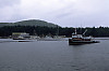
Wharf in Namu
This is current dock in Namu - large vessels can dock (on the left) and smaller boats (like the 90 foot curve of time)
|
|
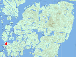
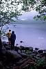
Lake Namu
We went for a swim! The lake is pretty warm and we had a good swim!
|

|
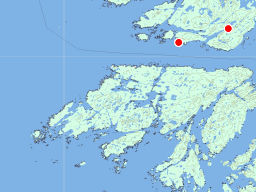
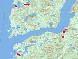
Cultus Sound Anchorage
This is our view from the Cultus Sound anchorage looking North. Tags: coast
John Harvey Photo > Mid Coast of BC on the Curve of Time > Spider Anchorage to Cultus Sound > Cultus Sound Anchorage
|
|
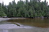
Cedar Stained Ocean
This is the other side of our hike in Cultus Sound. The water here is stained brown Tags: beach
John Harvey Photo > Mid Coast of BC on the Curve of Time > Spider Anchorage to Cultus Sound > Cedar Stained Ocean
|

|
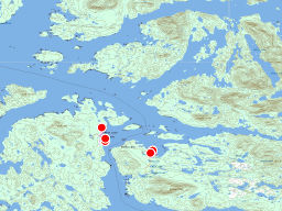
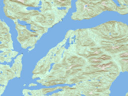
Entrance to Codville Lagoon
Codville Lagoon is a sheltered lagoon on the Eastern side of the Fisher Channel. Tags: coast
John Harvey Photo > Mid Coast of BC on the Curve of Time > Shearwater to Codville Lagoon > Entrance to Codville Lagoon
|

|
I just like this shot. Tags: coast
John Harvey Photo > Mid Coast of BC on the Curve of Time > Namu to Spider Anchorage >
|
|
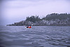
Jaques and Charles Kayaking
That rock wall is the southern end of Spider Island as seen from Fulton Passage. The waves were rough
|
|
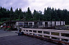
Accommodation in Shearwater
These mobile homes are part of the hotel in Shearwater. If you come
|
|
View of Shearwater Marina
Welcome to Shearwater BC! This is the resort half of Bella Bella. The large marina holds many tourist boats (many from the US) and the buildings house a small store, laundry, a post office, a general store and a large marine repair facility. There is a pub (with the metal roof in front of the mustard building). The big boat in the front is the Parry - a comercial tourist fishing boat - you live on board and go out in the runabouts each day to get the best fishing. John Harvey Photo > Mid Coast of BC on the Curve of Time > Cultus Sound to Bella Bella and Shearwater > View of Shearwater Marina
|

|
Landing for Trail to Sagar Lake
This is the beach head where you begin the hike to Sagar Lake. The sign
|