Photo Search Returned 41 to 60 of 81
|
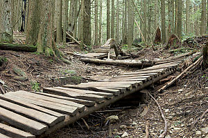
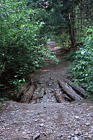
Bike Trail With Hump
I keep thinking that when you snap your frame and then puncture your abdomen with the torn frame tube it's a long bloody crawl to get to anything resembling a road and a hospital. I guess that's why I'm not much of an aggressive rider. John Harvey Photo > John Harvey Photo - Hiking > Baden Powell Trail > Bike Trail With Hump
|
|
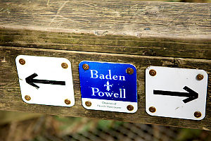
Trail Marker
These markers are found at most entrances and exits to the trail but along the trail there small orange triangles. Tons of them. John Harvey Photo > John Harvey Photo - Hiking > Baden Powell Trail > Trail Marker
|
|
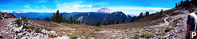
Trail Near Highest Point
I'm afraid I really tourtured the curves to get this image - bright daylight and slide film don't make good panoramas. People: David
John Harvey Photo > John Harvey Photo - Hiking > Elfin Lakes > Trail Near Highest Point
|
|
Start Of Hike
I was a bit worried starting in a logged out forest, but you get through it pretty quick. John Harvey Photo > John Harvey Photo - Hiking > Cerise Creek > Start Of Hike
|
|
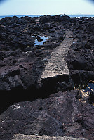
Worst Path Ever
Worst Path Ever John Harvey Photo > Trips out of the Country > A Third Trip to Japan > Ibusuki > Worst Path Ever
|
|
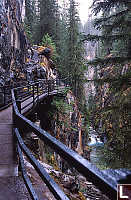
Walkway On Wall
These cat walks really are something else - they are drilled into the walls and very well constructed - perhaps the most expensive trail per meter I have ever seen. John Harvey Photo > Banff in Mid Week > Johnston Canyon > Walkway On Wall
|

|
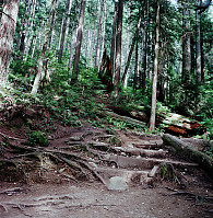
Hiking Down Trail
Hiking Down Trail John Harvey Photo > John Harvey Photo - Hiking > Mount Gardner on Bowen Island > Hiking Down Trail
|
|
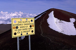
Trail to the Top of Mauna Kea
I believe the holes in the sign are so it won't blow over in the 60 kph+ winds. John Harvey Photo > Trips out of the Country > The Big Island of Hawaii > Telescopes on Mauna Kea > Trail to the Top of Mauna Kea
|
|
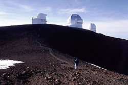
Walking Back to the Telescopes
The thin air up there has less than 70% of the oxygen we are used to so even a short John Harvey Photo > Trips out of the Country > The Big Island of Hawaii > Telescopes on Mauna Kea > Walking Back to the Telescopes
|
|
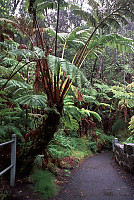
Giant Ferns
The ferns are well over 12 feet tall - I've never seen them before. John Harvey Photo > Trips out of the Country > The Big Island of Hawaii > Volcano National Park > Giant Ferns
|
|
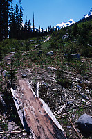
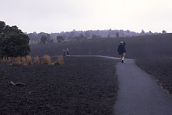
Walking Devastation Trail
A lava flow in 1959 ejected pumice cinders that covered a large region John Harvey Photo > Trips out of the Country > The Big Island of Hawaii > Volcano National Park > Walking Devastation Trail
|
|
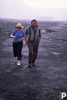
Walking in Kilauea Iki Crater
It was a little moist (blowing mist), but a lot of fun. People: Michael
John Harvey Photo > Trips out of the Country > The Big Island of Hawaii > Volcano National Park > Walking in Kilauea Iki Crater
|
|
Sign to Lost Lake
Would you have noticed the sign? The trail to lost lake is much less traveled John Harvey Photo > Brothers Creek > Sign to Lost Lake
|
|
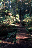
Rickety Bridge
See the hiding wood nymph? This bridge walks you over a boggy bit of trail. John Harvey Photo > Brothers Creek > Rickety Bridge
|
|
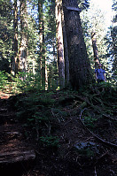
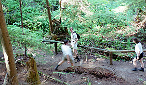
Mark Skipping Trail
The hike had a number of well used switchbacks - some of which Mark shortened. John Harvey Photo > John Harvey Photo - Hiking > Capilano River > Mark Skipping Trail
|
|
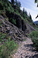
Rockfall under Power Line
The bubbly rocks show this area is the remains of John Harvey Photo > John Harvey Photo - Hiking > Cheakamus Canyon > Rockfall under Power Line
|
|
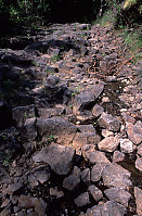
Columnar Basalt Trail
We are walking over the top of lava flow - you John Harvey Photo > John Harvey Photo - Hiking > Cheakamus Canyon > Columnar Basalt Trail
|
|
Broken Bridge
This is part of the 4x4 road up to Starvation lake. Tags: trail
John Harvey Photo > John Harvey Photo - Hiking > Cheakamus Canyon > Broken Bridge
|
|
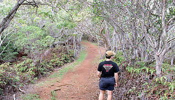
Hiking
This about half an hour into the Awaawapuhi trail - quite possibly the most slippery trail John Harvey Photo > Trips out of the Country > Kauai, Hawaii > Canyon at Kauai, Hawaii > Hiking
|
|
Part of the Trail
The trails are will maintained and not roads. Tags: trail
John Harvey Photo > Lynn Canyon > Part of the Trail
|