
Skagit River
The first overnight hike of 2002
Still early in the season, but
Andrea wanted to go hiking and camping so we tried to find a camp ground
that involved a little hiking but wouldn't be overflowing in this weekend
(June 1st and 2nd). Originally we were thinking of going to a place
on the Coquihalla, but asking around we found there was still snow on the
ground! Andrea found the Skagit river in one of her books and my 103
hikes had a good description as well.


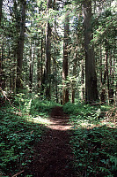
The trail is well developed (a
few newly blown branches), and in good shape. After about a km we ran
into a wet section - 50 meters of trail with 20 or so cm of water sitting
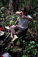
on it. My tall boots and gaiters worked for the dash, but Andrea's
boots didn't fare so well - thankfully Andrea had an extra pair.

Mine Near Silverdaisy Creek

A little less than 2km into the trail is an abandoned cabin and truck that
used to be associated with the Silverdaisy mine. I believe the mine
was opened in the 1930's, but there is no sign of a mine at the camp.
There is an old truck "parked" out front - decaying into the forest.
I don't know how they got it in here or where it drove to.


The cabin has two rooms - a bedroom (there were outlines for bed frames)
and a kitchen with a large old stove (now beaten up). The roof and walls
have holes and the floor is getting close to rotting through. Out the
window is an amazing view - a waterfall on Silverdaisy Creek.


After leaving the mine area we entered a section of pristine forest.
Most of this area was logged years ago, but a few sections of forest are untouched.
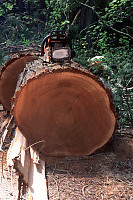
There are many fallen logs on the floor - sometimes stacked deep. A
forest fire would burn very well here.


At four km we came to Delacey Camp - a large flat area that has been cleared
to make space for tents. The river was flowing high - the high water
mark was just a few inches below the highest locations we could find to pitch
a tent.

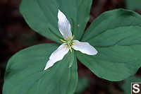
After setting up camp and eating lunch, we went our for a hike. We
walked further down south down the trail and took pictures of the local plant
life.



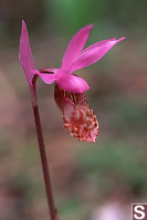
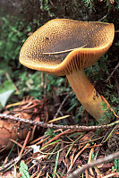

We came back after the hike and made dinner (spaghetti - it's light) and
popcorn over the burner. The camp site doesn't allow camp fires (there
is so much dead fall here and a root fire would take forever to put out.)
so when the sun went down, there really wasn't much to do. Tired from
the hiking we went to bed.
Climbing Hatchethead Mountain (a little)
The next morning we had our porridge and granola bar (also light) and decided
to go for a little hike. The hiking book suggested a short trail to
see rhododendrons. We hiked about 10 minuets south to Twenty Six Mile
Creek (also flowing high and fast) and just before the creek there is a little
trail that runs up the hill.


The trail is well marked with flagging tape, but recently felled trees
and branches block a few parts. After about a km of walking the trees
start to change and rhododendrons start shooting up. The rhodos are
much sparser than what you see in gardens, but still neet to see. We
only found one bush in bloom - unlike most, it was in full sunlight.


As we continued to
climb up, we left the rhodo zone and the trees changed to thinner pine trees.
Then, abruptly the trail ends. There is a bluff with a view of the
valley, but it's somewhat anticlimatic. We walked back down the trail,
and noticed a poorly marked spur that continued up the hill. We took
it on faith for a short period and then found the trail much better marked.

The trail continued up and up until we reached a clearing.
(It probably went even further - we didn't have the time explore it properly).
We had lunch here soaking up the view and cooling off from our hike.
The mountains on the center right of the panorama are labeled
Marmot Mountain,
but the snow covered peaks aren't labeled on my topo maps. A little
digging at the BC geographical database suggests it is probably
Mount Andrews.

We hiked back to camp, packed up, and hiked the 4km out. Overall
- a great hike! Below is the topo map for area - not terribly helpful,
but better than nothing.

Tags: derelict(5), flower(4), Do Not Tag(3), hiking(3), tent(2), trail(2)
People: Andrea(3)
From: John Harvey Photo > John Harvey Photo - Hiking > Skagit River
Last Modified Tuesday, June 9th, 2009 at 00:23:12 Edit
Copyright and Contact Information.

