
Desolation Sound

 Beauty close to the lower mainland
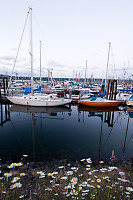
Desolation sounds is probably the closest
"getting
away" from Vancouver you can do with a sailboat. It used to be
pretty quite but
now in the summer months it can be downright crowded. My favorite
charter company was doing a trip there (it's nice to always go to some
place you haven't been before) and it went in late June - way less
crowding! There are two big gateway communities to Desolation
Sound - Campbell River
(Vancouver Island) and Lund (mainland). Campbell river was our
meeting point and we arrived just before dinner.
The Curve of Time was moored in the fisherman's wharf. It's a
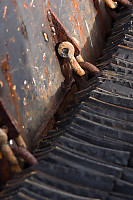
working wharf - tugboats, log pushers and industrial fishing boats.
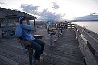
We
arrived the night before we sailed (other
than
flying, there is no easy way to get from Vancouver to Campbell river by
9am) so we took a walk around the docks at sunset. The local
wharf on the outside of the breakwater was pretty much a mecca for
fishing - no only were there permanent fishing chairs, there were also
dozens of holes drilled into the handrails to support fishing
rods. It's amazing there is that much fishing right next to town.
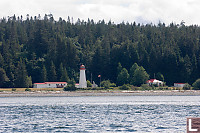
The
next morning we got up, load the last of
our
guests and headed out for our trip. Quadra Island dominates
the view from Campbell river and it took a while to go down the channel
and clear the southern tip before we could head back North to our first
destination - Rebbecca Spit.
Quadra
Island - Rebbecca Spit
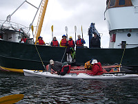
I was
actually quite keen to get in the
Kayaks and out
on the water. Rebbecca Spit provides a sheltered bay so it would
be a nice paddle. Once we got out onto the water we found the
wind was actually quite strong and without the rudder it was really
quite difficult to not get turned across the wind. As an
experienced kayaker, it was no problem, but for the newer people in our
group there were a few setbacks.

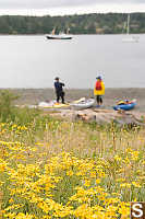
After our paddle we went inland to the spit and went for a walk.
The spit is a public park and like most of the gulf island, the parks
play multiple roles. This park had wild space and lots of plants
to see but also had playing fields and picnic bench areas as well as a
boat launch.
These islands are in a bit of a rain shadow so the plants you find here
can be quite surprising - sometimes marine species, sometimes plants
you would expect to find in more desert conditions.
With the wind, we didn't really want to leave
the protection of the
spit. We stayed at anchor that night and left the next morning.
Teakerne
Arm Marine Park
The next morning we passed by Cortes Island on the way to our next
destination. Desolation Sound has relatively few good anchorages
(it's quite steep in most areas which means the ocean floor is rarely
flat and shallow) and a large boat like the Curve of
Time needs a fair amount of space clear to set anchor. Our
earliest choice was already full so we poked into a few other spots
going to our second choice anchorage. First was the waterfall at
the end
of Teakerne Arm. This wasn't a good place for an anchorage but
the waterfall was neat to see and we went inland for a nice walk.
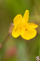
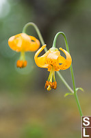
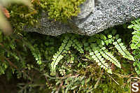
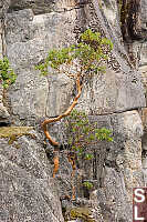
Again, the plant life was fun. Very small spaces (perhaps a
wetter part of a rock face or a shaded space) would hide plants that
were quite nice to find. It amazes me how a single example of a
species can grow so distant from any other example.
Refuge
Cove
Desolation sound is pretty large and for a sailboat without a freezer
it could be quite a while to go without resupply. The major towns
of Campbell River
or Powell River are both a long way away (by sailboat standards) so
there is a need for a
nautical version of the "corner store". Refuge Cove hits that
niche and we were heading by
with a boat full of women - we had to stop in for a bit of shopping.
Sadly, the ice cream counter was closed (no sign - but they would have
had a dozen customers). We looked at the boats moored at the
docks and while the majority of them were American, most boats were
relatively local.
Prideaux
Haven
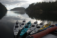
Our anchor for the night was Prideaux
Haven. The
large anchorage is actually a number of islands that form an outer
barrier and then inner islands that segment the space into shallow and
deeper anchorages. We felt like we were nearly alone here.
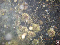
The next morning (on a coincidentally low
tide) we
went out for a
paddle. The low tide and quite weather made for some beautiful
glass like conditions. Tidepooling from a kayak is actually quite
reasonable - you can get to within inches of walls that go right to the
depths and some species come up on walls where they would never be
caught on flatter land. Some of the bright species like star
fish and sea cucumbers can be spotted quite a ways down.
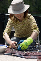
After
a lovely morning Kayak, we came in for lunch and found the crew
had secured us some lovely local oysters. We all got a shot a
shucking which was easier than I seem to remember it - I think the
thick gloves gives you a bit more bravery about using the knife.
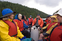
In the afternoon we went for a zodiak ride to
explore
what might have once been a native village site. The conditions
were good - fresh water supply, more than one exit, good lookout
potential, nice beach, but this area probably hasn't been habitated for
150 years and it was logged at some point in the last 100 years.
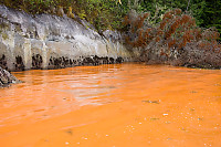
As we came around the corner I saw something
I'd never
seen before - a small patch of the ocean was orange. I've seen
brown ocean from cedar stained streams but Orange was totally new to
me. We came in to take a look and there was a strong fishy
smell. Current theory - one of the shell fish species
around here is coming to reproduction season and they are heat
sensitive - when the ocean hits the right temperature, they let
go. Orange Ocean. Cool.
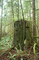
We landed on the beach and walked around
through the
second growth forest. The forest was pretty open and the floor
was a combination of soft moss mats and rotting logs - almost like
walking on a mattress. One of our group was stung by a wasp (I
was
stung 5 times the year before so I know how much it sucks) and the
guide had an innovative solution - banana slugs excrete a slime than
numbs things. We used a banana slug to reduce the pain.
Walsh
Cove
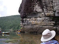
The next morning we moved the Kayak up to
Walsh
Cove. Walsh Cove is further inland and the terrain is steep
here - without the ocean this would probably be a canyon.
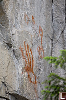
At some point in the past, this site was a
native
settlement. On the rock cliffs above the cover (protected from
the elements) are pictographs painted onto the rock. Some of the
figures can be made out quite clearly, even though they must be more
than 100 years old. Some figures are quite easy to match to real
world objects - other graphs are completely alien.
As we kayaked around, we noticed the orange
water had caught up with
us. The spawn was thicker in protected areas where the waves and
wind didn't push it around. I half expected a humpback whale to
show up for the food, but we weren't so lucky. (We did briefly
see a minke whale but he was cruising and we had no chance of keeping
up).
Oyster Farm
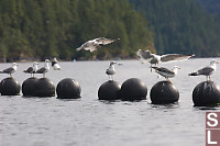
Across the arm from our anchorage was an oyster farm. It's
basically a bunch of floats holding ropes seeded with baby
oysters. The oysters get bigger and eventually some boat comes by
pulls up the ropes to harvest the oysters.
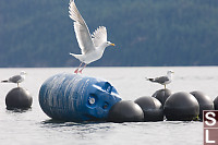
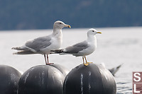
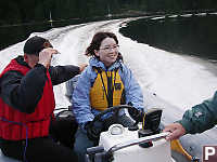
While we were away, the crew had set a prawn
trap. Not knowing how productive our drop site was, we went out
late that evening to check out our catch. Sadly, we caught
more fish than prawns (small fish can also get into prawn traps and the
rapid ascent from the bottom kills some species. We hoped for
better luck over night, but the next morning had a pretty poor showing.
Cortez Island - Whaletown
Sadly, all good trips come to and close. This trip ended with a
twist - on the way back out of the wild we stopped in at Cortez
Island. Gorge Harbour has a gorge entrance and lots of good
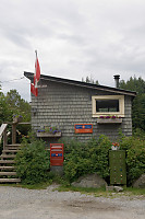
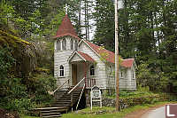
places to moor. We came ashore and went for a walk to "Historic
Whaletown".
Tags: BC fauna(9), boat(7), kayaking(6), flower(5), Do Not Tag(5), shallow depth of field(4)
People: Helen(2)
From: John Harvey Photo > John's Overnight Page > Desolation Sound
Thank you so much for this wonderful pictorial display.
Vicki
Saturday, July 24th, 2010 at 18:11:13
Last Modified Saturday, January 21st, 2023 at 23:45:13 Edit
Copyright and Contact Information.

 Beauty close to the lower mainland

 Beauty close to the lower mainland


