
Kayaking in The Southern Gulf Islands

Exploring Canada's newest National Park
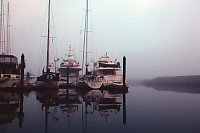
This was my first trip
leaving out of Sydney Harbour,
and one of the first times in a long time I had seen thick fog.
Jan welcomed us on board and gave the safety talk and introduced the
crew. Before we left, we poked around the dock looking at
the local wildlife.
The floats are actually quite productive footholds for sea life.
What at first looks monotonous is actually quite diverse - different
floats had starfish, urchins and shrimp.
Sydney Spit Marine Park, Sydney
Island
We set off in the fog to find our first destination - Sydney
Island. Half of
First we kayaked around the shallow harbour area and then pulled into a
sand beach to go for an inland hike.
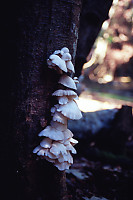
Like most of the
Gulf Islands, Sydney Island at one
point was used for farming. There is a network of slowly
overgrowing roads and a few large open fields that were once used for
grazing. The area had rain in the few weeks before we
arrived and the mushrooms were loving it - every turn in the road
showed off a new crop of ever different species of mushrooms.
Some mushrooms were extremely localized - others were common. The
scale varied tremendously, from the soccer ball sized Bearded Tooth to
the marble sized Puff Ball Mushrooms.
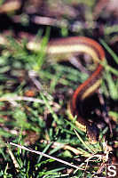
The open field (now bumpy with large tufts of grass)
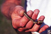
had a surprise for
us - a small garter snake. It always amazes me when small animals
make
it to these islands and set up a breeding population.
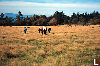
We kayaked back to the boat for lunch. After a great lunch, we
kayaked back to the spit area for a bit more exploring.
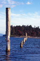
The
spit has a line of pilings along it's
back, but it
no longer follows the straight line of wood.
Only after I had walked much of the spit did I see signage recognizing
this as a national park. Most of the provincial park signs are
still there (don't walk on a steep slopes, don't bother the wild life -
that kind of thing), but they have little stickers blocking out the BC
Parks logo. I believe we were far enough into the season that the
ferry service was no longer running.
We kayaking back to the curve and while we enjoyed dinner, Jan moved us
to our next location - Pender Island
Beaumont Marine
Park (South Pender Island)
Some of us were
feeling the
upper body workout from
yesterdays kayaking so a walk was a good complement for the
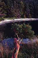
morning. We rode out in the Zodiak to the Midden beach at Beaumont
Marine park and started our walk. The walk follows the shore for
about a kilometer and then heads inland and up to Mount Norman.
Walking through the forest was again a mycologist's delight.
As we hiked up from the shore line (lots of arbutus trees), the ecology
changed. We started to see maples, and then douglas fir's.
At the top of Mount Norman, the ecology was completely different than
what we experienced at the shore line.
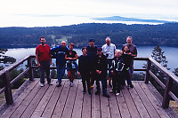
We soaked in the sights and appreciated the mountain that we had
climbed. We considered an alternative landing spot (the sand bar
near the split between the islands), but we decided to walk all the way
back.
On our Zodiak ride back to the curve, we happened to flag down a high
speed whale watching boat from Vancouver that day trips across to the
gulf islands. The whale forecast was grim - no significant
sightings in the gulf Island for a week. There were two humpbacks
further down toward Victoria, but they were in the opposite
direction. We got back on board for lunch, and set off for our
next destination.
Winter Cove, Saturna Island
Of the major gulf islands, Saturna is probably the least
populated.
It's the last stop on the ferry route. It's also surrounded by
wildlife. The curve set down anchor in Irish Bay closest to
Samuel island - a privately owned island that is mostly used for
farming. We went out for a kayak. Hugging the shore of
Samuel Island, we spotted 4 heads bobbing up and down in the water - too
small to be seals - River Otters! (Sea Otters don't yet occur
this far south that I know of). They weren't particularly curious
(they didn't approach), but we later spotted them on land.
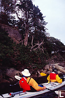
We paddled round they bay looking at the
trees growing
low to the water (not the Arbutus and Oak we had seen earlier).
We paddled over to Winter Cove Marine Park on Saturna island and got
out for a short look around. The marine park includes a spit of
land that reaches out toward Samuel island leaving a small gap for
high speed flows during tide changes.
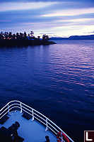
It was getting on (6pm?) by the time we
started back for the boat and
we enjoyed a sunset paddle.
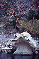
The next morning we got up for a paddle out between
the islands.
We started hugging the coast of Samuel island was we came out of Irish
Bay. The sandstone here is carved by the wave action, and
although not as dramatic as other galleries in the gulf islands,
it is beautiful none the less.
As we rounded the point, we were treated by a very patient Harbour
seal. Generally harbour seals don't like being approached when
they are on land. This seal was very patient while we glided
past, my camera shooting the whole time.
Very happy experience. We continued paddling up the now flooding
channel and tried to cut across to Mayne Island. My kayaking had
an "exciting experience", and I wound up going for a swim.
Thankfully all of my camera gear was in a sealed pelican case and no
camera gear was lost. (There is a carbon fiber tripod slowly
eroding on the ocean floor though). A little cold, but none
the worse for wear, we paddled back to the Curve and enjoyed a warm
shower.
Tags: gulf island(24), mushroom(12), beach(12), BC fauna(8), marine mammal(4), rock(3)
From: John Harvey Photo > Kayaking in the Gulf Islands
From: John Harvey Photo > John's Overnight Page > Kayaking in the Gulf Islands
From: John Harvey Photo > Kayaking in the Gulf Islands
Last Modified Tuesday, June 9th, 2009 at 00:59:31 Edit
Copyright and Contact Information.


