Aristazabal Island - Day 7, 8, 9

The outside of Aristazabal and back home
Day 7 - Chapple
Inlet, Princess Royal Island
After all of the whale watching of the previous day,
it was hard to imagine what the next day would hold. After a
morning paddle around the inlet we set off across the Caamaño
Sound to Rennison Island on the outside of Aristazabal. Jan saw a
whale blowing in Parker Passage so we set off in the Kayaks to see if
we could catch up. The whale turned out to be much faster than
our paddling, but that didn't end the fun. We turned south to the
Anderson Islands and spotted a sand beach on the largest of the Islands.

The curve
had moved several km down the chain of Islands so we were off
for a long paddle. We hugged the islands and paddled across the
large channels seperating groups. Steve got out a fishing line
and pulled up two blackfish - larger than I had ever seen. We
watched birds feed on what we throught was herring. And we
paddled.
After a good day of Kayaking, Jan moved the boat into a nearby
sheltered inlet and we settled in for dinner. Just after dinner,
we enjoyed a spectacular sunset and the clear, unpolluted starry night.
Day 8 - Kettle Inlet, Aristazabal
Island

We
knew today was going to be a long day of sailing
so we got up as early as possible. When I got outside I realized just
how early we were up - it was sunrise over Aristazabal. Erie, but calm
for kayaking.

We
rounded
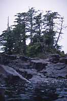
the islands that formed our shelter and were quite surprised to see the
rocks were made of columnar basalt. The twisted columns came out
in all angles, some times twisted into waves by some tortured volcanic
process. Being early in the morning, shooting dark rock from a
moving kayak, it was hard to do justice to the formations, and I so
wished I could get out onto the rocks and shoot from a tripod.
As we
continued
around the islands, we could see just how extensive the rock formations
were. Some columns were straighter or better defined than others,
but most were distinct and surprising devoid of life.
We had to get within striking distance of Bella Bella today and that
mean many hours of driving the boat. Journals were updated, books
read and we watched the islands go by.
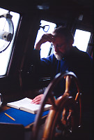
It
rained. Fog came in and left, but the rain persisted. As we
traveled down Laredo Channel, Jan noticed some large splashed on the
bow, and then another. Dal's Porpoises were riding our preasure
wave on the front of the boat. They were only there for a short
period of time, but it was nice to have visitors for a little while.


Once we got past the protection of Aristazabal Island, the waves from
the ocean was enough to send me to my bunk. I woke up after the
sun was down and we were anchored in St. John's Harbour.
Day 9 - St. John's Harbour, Bardswell
group
We awoke to rain, but for our last day we weren't going pass up a
paddle. We got into our best waterproof gear and went for a
paddle. The rain never really relented, but at one point when the
downpour seemed it's heaviest the nearly flat ocean took the appearance
of carpet - the rain drops were bouncing off the surface as they hit
and so many fell that there seemed to be more drops in the air than
water surface. Even the best gear can't put up with this
moisture so we eventually relented, returned to the Curve and got ready
for our next destination.
Fisher Point
We visited fisher point by Kayak on our first day, but the ocean was
too rough to permit an nearby landing by Kayak and the safer landings
were too far through the impossibly thick forest to get to the
point. On our last day we were a little more determined. We
all loaded into the Zodiac and Jan took us to a near by rock shelf - a
steep wedge of rock descending into the ocean with waves washing it
clean. Driving the nose of the zodiac onto the rock, Mike
and Steve got out and stabilized the boat enough that the rest of us
could get out and pick out way up the rock face. At the top we
found a trail into the forest.
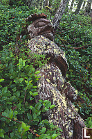
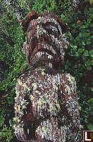
At
the
very end of Fisher point once stood two totems or "watchmen".
They have at one time both fallen, and only one is currently
standing. Once the totems are on the ground they quickly erode
under the life in the forest.
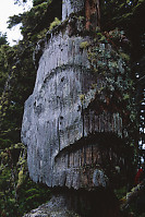
The one
standing totem is harder to see -
half of the face is seriously consumed and it is standing with a
prominent view of the channel, but with limited footing in front of
it. It's amazing to me to think these objects were probably
carved more than 100 years ago.
Walking back down the trail to the landing site, we called to Jan to
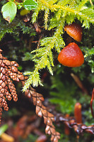
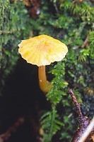
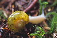
bring back the Zodiac and had a few minutes to explore. The area
was rich with small things on the forest floor and I gladly took
photos. It was raining outside the forest, but under the canopy
of cedars, the rain was reduced to large soaking drops that
occasionally made it to the floor.

Tags: beach(4), kayaking(4), native art(4), columnar basalt(4), totem pole(4), mushroom(3)
From: John Harvey Photo > Aristazabal Island > Aristazabal Island - Day 7, 8, 9
From: John Harvey Photo > John's Overnight Page > Aristazabal Island > Aristazabal Island - Day 7, 8, 9
In 1979 I conducted hydrographic surveys in Laredo Channel just to the east of Aristazabal Island. These were the first charting surveys carried out since the original surveys were conducted in 1922.
After the discovery of a new and dangerous shoal near Wilson Rock, but not Wilson Rock a 20,000 bauxite ship ran aground on this shoal. The colour of the buoy marking Wilson Rock was technically incorrect and should have been changed after the discovery of the shoal in 1979.
The whole wonderful area that includes the many inlets and waters of Aristazabal Island is a naturalists dream world and the majority of it remains unsurveyed to modern standards. it remains a dangerous area for ships without local knowledge.
Barry Lusk
Wednesday, March 18th, 2009 at 13:01:01
Last Modified Tuesday, June 9th, 2009 at 00:52:30 Edit
Copyright and Contact Information.


